Walks Around Tarvin
LOCAL WALKS.
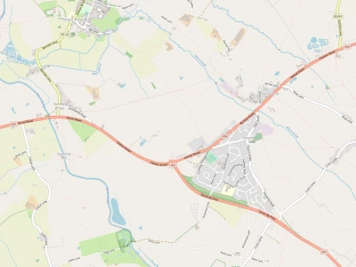
The Local Area.
Tarvin is situated on a sandstone outcrop above the Cheshire Plain. This means the surrounding area is mainly flat, so that panoramic views are rare. The best local views of this nature are by Kelsall (Dodds Rough) and Willington (Little Switzerland). Although the rest of the area is mainly level, it has many varied aspects and much history. It is also exceptionally well served with public rights of way, so that walking within the local area is relatively safe, easy and can be a very rewarding experience.
Types of Walks.
Walking can fulfil a range of expectations. At the least strenuous level it might be a one hour stroll simply showing visitors the local sites. At the other extreme one could take a full day exploring the local environment. The entire range of possible walks then have different implications in terms of footwear, provisions, health and wayfaring skills. Here the walks have been split into 3 categories, short, medium and long, with the following meanings.
a). Short. Walks of less than 4 miles that can be undertaken without any special provisions or planning. These will be along lanes or paths so that no special footwear is required. Walkers would not be expected to meet any farm animals, and therefore these walks would be suitable for people of all ages.
b). Medium. Walks of between 4 and 6 miles that can be undertaken with minimum provisions or planning. These will include some fields and tracks so that suitable stout footwear is probably advisable. Walkers might meet some farm animals, and therefore these walks might not be suitable for all people.
c). Long. Walks of between 6 and 10 miles that would require provisions or planning. These will involve uneven and possibly muddy terrain, so that walking boots or shoes would be required. Walkers are highly likely to meet farm animals, and therefore these walks are only really suitable for experienced people.
The Walks Outlined
A few walks in each category are given in the pages following. For short and medium walks experience is not assumed, so each walk has provisions to access a route map and a narrative description. For the long walks experience is assumed, so that only a route map is provided.
The layout used is that a brief description will be given of each walk, together with a highlighting photograph. This is intended to allow some judgement of walk suitability. Further details including print out facilities will be given in an attached URL. Please note that a modern browser (later than Internet Explorer 8) will be required to print the route maps.
Short Walks.
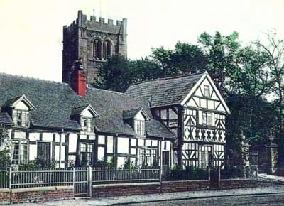
Tarvin Central
This is a circular stroll of 2.4 miles around Tarvin village giving
some details of local history. It starts at the playing field,
goes through the village centre, behind and around
St Andrews Church and returns to the playing field
via the Tarvin Woodlands
Photograph – View of Church Cottages
To view and print out details please click the attached link (opens in a new window)
http://www.walk4life.info/walk/tarvin-central
Tarvin Sheaf
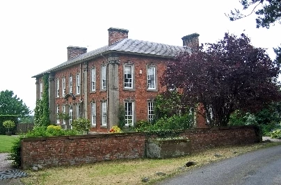
This is a circular walk of 3.7 miles to the south of Tarvin. It starts at the playing fields, then crosses the A51. It goes on the track past Hockenhull hall, then on the lane to Sheaf farm. It circumnavigates Broomheath plantation before returning to Tarvin. It then follows the Woodland walk back to the playing fields
Photograph – View of Hockenhull Hall
To view and print out details please click the attached link (opens in a new window)
http://www.walk4life.info/walk/tarvin-sheaf
Medium Walks
Tarvin Gowy & Walk MillI
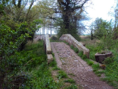
This is a circular walk of 4.9 miles to the south of Tarvin. It starts at the playing fields, crosses the A51, then along the track down to the packhorse bridges. It then follows the river Gowy across fields to visit Walk Mill. On the way back there are 2 options for the return to the A51, one via fields & one via Stapleford farm. It then follows the Woodlands walk to return to the playing fields
Photograph – View of Packhorse Bridges
To view and print out details please click the attached link (opens in a new window)
http://www.walk4life.info/walk/tarvin-river-gowy-walk-mill
Tarvin Barrow& Stamford bridge.Tarvin Barrow& Stamford bridge.
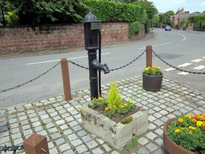
This is a circular walk of 4.3 miles to the west of Tarvin. It starts at the playing fields, crosses the A54 and then goes via fields towards Barrow. There are often cows in these fields. It then goes past the mill, the village pump and the church via fields to Stamford Bridge. It the follows the course of the roman road to meet and retrace its steps back to the playing field.
Photograph – View of Barrow Village Pump
To view and print out details please click the attached link (opens in a new window)
http://www.walk4life.info/walk/tarvin-barrow-stamford-bridge
Long Walks
Tarvin NE
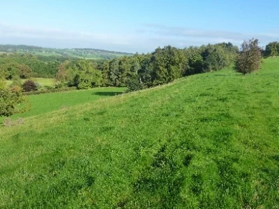
This is a 10 mile walk around the NE of Tarvin. It passes interesting terrain and involves a panoramic view by Kelsall. It starts at the playing field, passes via Tarvin mill & through fields to Ashton Hayes and then Peel Hall. From there it goes over Brines Brow towards Kelsall and returns across fields to Tarvin Church via Oscroft. From Tarvin Church It goes through the Woodland walk to return to the playing field
Photograph – View of Dodds Rough, Kelsall
To view and print out details please click the attached link (opens in a new window)
http://www.walk4life.info/walk/tarvin-ne
Tarvin NW
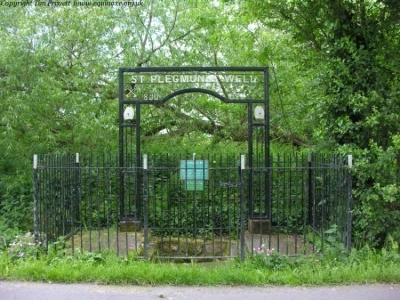
This is a 10 mile walk around the NW of Tarvin. It is mainly field walking, but can be quite pleasant. It starts at the playing field, crosses the A54 to Barrow village. It the passes via fields to Plemstall Church and out to the adjacent well. From the church it then crosses fields to reach Little Barrow. From there it crosses the branch railway line and via fields to Peel Hall. After Peel hall it heads back to return to the playing field via Tarvin Mill.
Photograph – View of St Plegmund's Well
To view and print out details please click the attached link (opens in a new window)
http://www.walk4life.info/walk/tarvin-nw-0
Tarvin SE
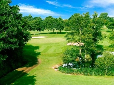
This is a 10 mile walk around the SE of Tarvin. It has a fair amount of field walking, but with some variations in scenery. It starts at the playing field and leaves Tarvin via Oscroft and Pryors Hayes Golf Club. From there it goes along tracks to Duddon Mill and Duddon to Burton, (if muddy this can be bypassed by local lanes), and then by fields to Walk Mill. From there it passes Cotton Farm and the packhorse bridges to return to the playing field via the Woodland walk
Photograph – View of Pryors Hayes Golf Course
To view and print out details please click the attached link (opens in a new window)
http://www.walk4life.info/walk/tarvin-se
Tarvin SW
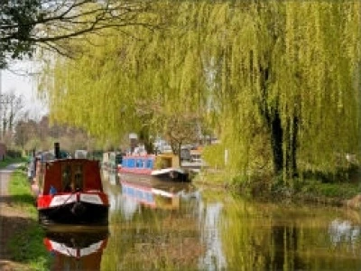
This is a 10 mile walk around the SW of Tarvin. It is probably the most interesting of the long walks as it has a varied mix of terrain. It starts at the Playing Fields and passes via the Woodland walk and the packhorse bridges, and then by fields to the S.U. canal. It leaves this at Christleton and passes via Littleton to Vicars Cross Golf Course. It then goes through Guilden Sutton and Great Barrow village to return to Tarvin playing field
Photograph – View of Shropshire Union Canal
To view and print out details please click the attached link (opens in a new window)
Quick Links
Get In Touch
TarvinOnline is powered by our active community.
Please send us your news and views.