The Gowy and the sea
Climate change is constantly in the news. Rising temperatures and sea-levels are part of a cycle repeated many times in Earth's history. We are within an interglacial period lasting, with warmer intervals, many thousands of years. The land surface has changed many times most recently during the last Ice Age. A time when ice hundreds of metres thick advanced across Cheshire and its retreat raised sea-levels across the world.
It was no surprise then to learn the sea affected the Gowy some 12,000 years ago. Not until the Manchester Ship Canal was built in 1893 did this mix of salt and freshwater end. Little wonder the marshlands of the Gowy were so extensive, long-lasting and such a hinderance to human activity. After all, for a small river to have so great an influence on the landscape seems far-fetched.
An online search offered something so thought-provoking as to start an unexpected line of research. This document was presented by Dr. J. Black in 1846 to the Manchester Literary and Philosophical Society. Basically, he maintained a high tide would 'reach far up the vallies of the Dee, Gowy, Weaver, and Mersey' and 'at a level of half-tide the Ince marshes would be widely overflown' and reach four and a half miles up the Gowy.
This would mean the tide reached Bridge Trafford. However, this does not appreciate the reach of the highest tides. For instance, the Dee bore is a mini-tidal wave occurring mostly at the highest Spring tide. Moving up the estuary the tide becomes channelled to create a bore of up to 5ft until by Handbridge it is hardly visible; the Mersey has a lesser bore. The Gowy does not have such drama though the highest tides may have reached as far, as some writers suggest, Huxley.
Mersey tides are no longer a threat to the Gowy. Yet, the marshes were created in the most recent geological past and now sustained by the Gowy itself. Looking back two million years in the Gowy's story gives clues to the Gowy today. Then it was one of many streams passing through a marshland landscape. A time when modern humans were beginning to arrive from the Africa after the last Ice Age: The Quaternary period.
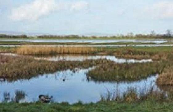
The ice sheet completely changed the landscape beneath and ahead of it. Millions of tons of material carried within and under the enormous weight of the advancing ice was carried by meltwater. Over thousands of years the sea-level rose by a hundred metres. Much of Cheshire was covered to leave islands of dry land with stands of trees, grasslands and reedbeds, swamps and pools. Woolly mammoths, rhinos, cave bears and other land and marine creatures faced extinction as humans arrived from the south.
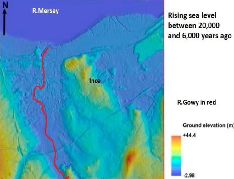
The map below shows the effect of the Mersey on the Gowy after the last Ice Age.
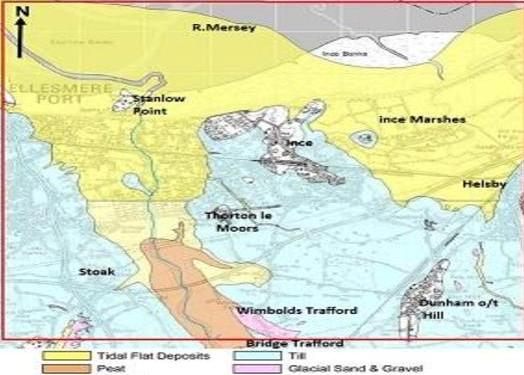
Blue represents what the ice left behind. The most significant feature is the tidal sediment dumped by the Mersey. The sediment load of the Gowy and tributaries was left as alluvium. Peat, the permanently wet land where decaying vegetation builds up over a long time.
Intriguingly, the Mersey deposits match the Gowy valley, or rather, its catchment area. Did the river exist at all or was it simply the low-lying nature of the landscape? Was the Gowy a much bigger river like the Weaver is today? After all, both river sources are today, at least, in the same field below the Peckforton Hills. So why are the two rivers so different in size when they share broadly the same landscapes?
This fascinating map suggests a reason for the size difference in the two rivers; a product of the last Ice-Age.
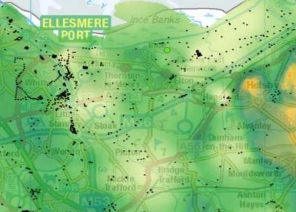
Buried valleys
The pale yellow/green shows the area of buried valleys. The research suggests they are not continuous features though there appears to be a match with the course of the present Gowy. Such valleys were created by meltwater under the ice-sheet, possibly enlarging an earlier stream channel, to form a 10m deep valley. As the ice retreated the valley was infilled with a chaotic mix of rocks, silt, sand and gravels.
Was the historic course of a wider, deeper and more powerful Gowy, now diminished, unlike the Weaver? The Weaver is twice the length of the Gowy, has a much larger catchment area gathering more water to erode a deeper, wider valley. Most likely this is enough. If, as proposed the Gowy flowed in a buried valley perhaps, the Weaver valley still includes in its journey to the Mersey.
Hopefully, the theories offered here at least gives a new, original and thought-provoking vision of what might have been.
Quick Links
Get In Touch
TarvinOnline is powered by our active community.
Please send us your news and views.


