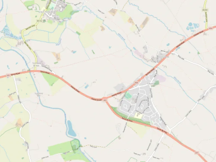
Green Belt Land in Tarvin


Land Bounded by the A54/A51 near Tarvin Roundabout
In November 2011, as part of a comprehensive study of all the potential land use sites in Tarvin, the Parish Council agreed the following statement about the above land which lies to the rear of Crossfields and is currently accessed by Townfield Lane.
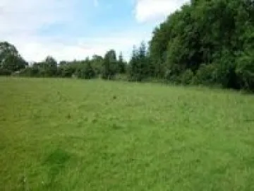
"This land has not been included in the Strategic Housing Land Availability Assessment as part of it is designated as Green Belt. The rest is currently designated as recreational land and it is used as a livery stables/grazing for horses. The Green Belt designation is probably unnecessary being a residual area left after the building of the by-pass. The area could be more intensively developed for recreational use and the Parish Council has no objection to a certain amount of residential development within the area. Development should be subject to the following constraints:
1. A footpath and possibly a bridle way be incorporated within the noise barrier along the by-pass side and maintained to the same high standard as the Community Woodland and enabling a new walkway for Grosvenor Road residents to access the village on foot.
2. Vehicular access should be from the main road only, possibly following a re-engineering of the roundabout.
3. Pedestrian access should be incorporated through Crossfields to integrate the development into the existing village community."
At the request of a Councillor and in response to recent and potential developments in the village in the last two years, the Parish Council is reviewing its position.
The pressure for new housing development in Tarvin has arrived sooner than the Parish Council anticipated and before the Cheshire West and Chester Council Local Plan has been formally adopted. Whilst the arrival of the Saxon Heath estate was known about when the above land was previously considered, it was not anticipated that the landowners along the east side of Tarporley Road would start discussions about housing developments so soon.
The Parish Council is working to achieve development in this area that would incorporate a Car Park and a new recreational area that would include new playing fields, an all-weather pitch and changing facilities. Obtaining these will not be easy given the multiple ownership of the land and cannot be guaranteed.
The Parish Council is aware of the presumption of development that is part of local and central government policy. It is also aware that the 250 new homes suggested in the draft Local Plan might now be deemed a minimum number and not a maximum number. The Parish Council also notes that outline planning permission for two houses has been granted to the owners of the land between Bank Cottage and Hillcrest, land that falls into the same Green Belt definition as the larger area of land above. The Parish Council did not recommend approval of this planning application. The Council objected stating that it was Green Belt land and that there were no special circumstances to support the application.
The Green Belt designation on this land is still an anomaly in terms of acting as a deterrent to communities growing together. However it is the only piece of land within the Parish settlement area that is specifically protected (during the lifetime of the soon to be adopted Local Plan) from development at the present time. It carries the designation of recreational land and the Parish is greatly in need of more recreational space. With vehicular access for any potential housing development to this area being very difficult to achieve, the possibility remains for it to be used more intensively for recreational uses.
Given the above uncertainties the Strategy Working Party would like to recommend to Council that the land remain designated as Green Belt in the foreseeable future and that the Clerk write to the landowner inviting him to informal discussions to see what changes /improvements to the recreational use of the land might be possible to increase the access of the land by more local residents.
Ed. This report was tabled at the last Parish Council meeting and has been a subject raised by Community residents on more than one occasion at the Open Forum section of Council Meetings
Quick Links
Get In Touch
TarvinOnline is powered by our active community.
Please send us your news and views.